
- Thread starter
- #1
Days 0.5 and 1 (June 15 Fourmile Area and June 16 Half Moon Gulch):
So with my wife needing to be in Denver for work June 20 through June 22 and having a job that observed the Juneteenth Holiday, we decided to take a road trip into Colorado to beat the heat (and chose a wonderful week with Phoenix topping out at 117 while we were gone). We quickly realized that despite the mediocre snow year in Colorado, there was quite a bit more snow remaining above about 10000 feet than we anticipated (first lesson learned, don't plan a Colorado trip expecting to wheel much before mid July if wanting to get above 11000 feet).
We stopped in Durango, CO our first night to split the drive up to Dillon, CO roughly in half and decided to take a short detour to checkout the Fourmile Travel Management Area just to the northeast of Buena Vista, CO. We were using Charles Wells' Funtreks book and decided to follow his suggested 24.7 mile loop (trail #45 in the 4th edition book). We figured with a maximum elevation of 9800 feet we'd probably be okay for not finding any snow (and we really didn't).
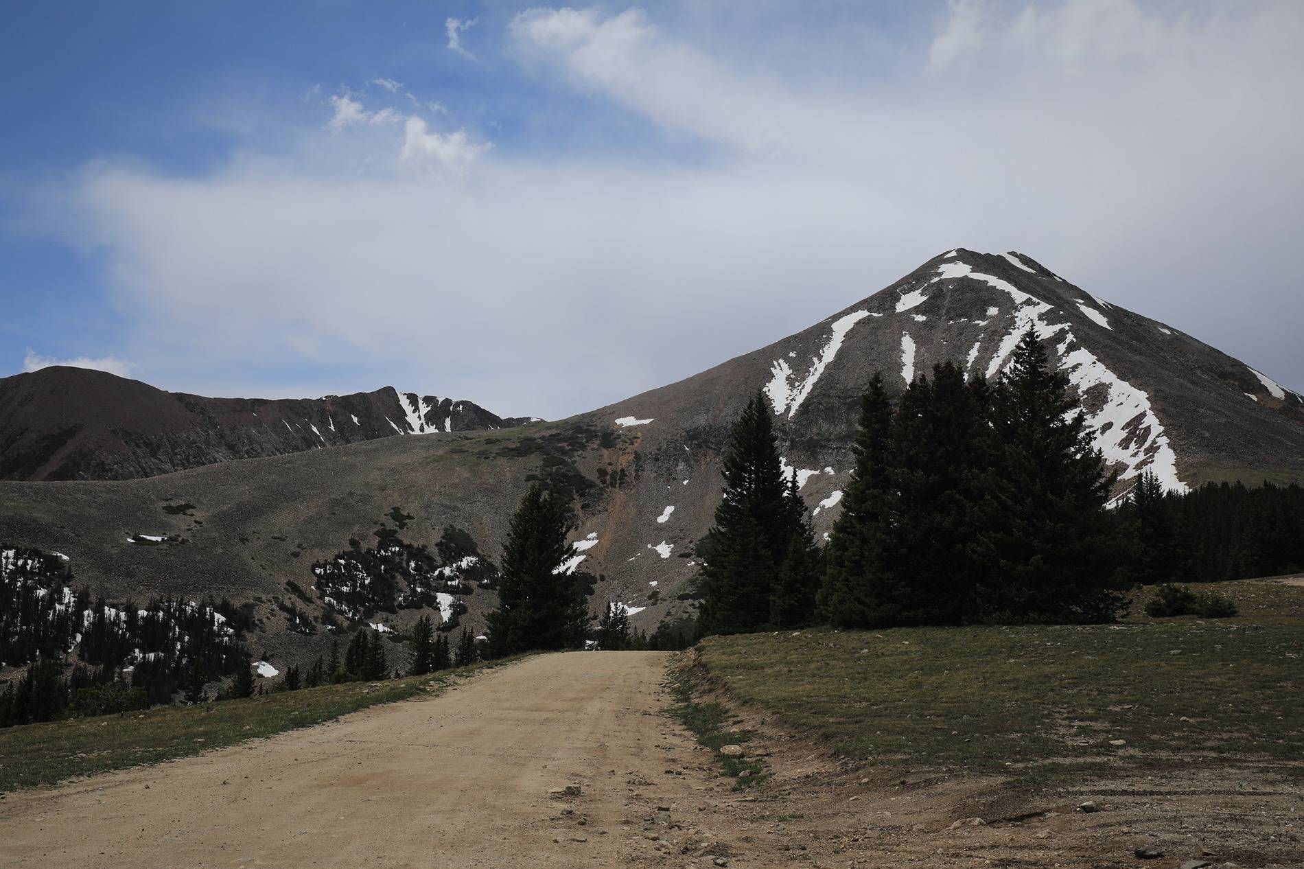
Trail was a nice mix of dirt road (passable to AWD with some clearance), a few rockier sections that were slower going but still pretty easy, and some sandy rolling areas near the end. Overall we had a great time and this was one of those areas that was just fun to drive around in (good views and interesting terrain with nothing being particularly challenging). After roughly a couple of hours we spit back out on CO24 to continue our drive up to Dillon (where we were staying for the next 4 nights).
For our first full day focused on wheeling, we decided to check out Halfmoon Gulch and the Champion Mill (#62 in Funtreks' book, rated moderate and level 5 on OnX). This trail is accessed just south of Leadville. We were a bit nervous about the creek crossings being called out as being nearly 30 inches deep at times and figured we could have snow problems, but decided to chance it as this road does not have any seasonal closure gates. Long story short, this probably ended up being the best day of our trip as we made it all the way up to the mill at 11580 feet without getting stopped. The trail up to the Mount Massive trailhead at about 2.2 miles wasn't too bad, but did have one narrow, rough shelf area that required taking your time and not getting too close to the edges. The creek crossing just beyond this point though was definitely nerve racking with water around 2 feet deep requiring driving up the creek slightly while making a relatively sharp turn in deep water to get out the other side. I figured with a 37" fording depth we'd be okay, but you could definitely feel the current on the vehicle and the water was definitely up to about the bottom of our grill at the deepest point. We continued up from here wondering if we were going to hit snow at some point but ended up lucking out as we made it the full 7.4 miles to the gate below the mill and found it open and able to drive straight up to it. The optional side road to the Champion Mine was blocked by snow shortly above the turn off and we gave up hiking once we were postholing through a foot plus of snow trying to continue up the road.
The mill was incredible though. This structure is likely going to collapse at some point in the next 10 to 20 years I imagine and I highly recommend checking this place out if able to do it. We spent awhile exploring and taking pictures of the area.
We drove back down finding a nice dispersed camping area to have our picnic lunch and then worked our way back to Leadville. We decided to stop at the Mining Museum there and actually found it quite interesting and worth the stop (plan on an hour or so to check it out depending on how much history you want to read about).
Emboldened by our success this day, we decided we'd do Georgia Pass the following day just outside of Breckenridge. I'll post that one up when I have a bit more time!


So with my wife needing to be in Denver for work June 20 through June 22 and having a job that observed the Juneteenth Holiday, we decided to take a road trip into Colorado to beat the heat (and chose a wonderful week with Phoenix topping out at 117 while we were gone). We quickly realized that despite the mediocre snow year in Colorado, there was quite a bit more snow remaining above about 10000 feet than we anticipated (first lesson learned, don't plan a Colorado trip expecting to wheel much before mid July if wanting to get above 11000 feet).
We stopped in Durango, CO our first night to split the drive up to Dillon, CO roughly in half and decided to take a short detour to checkout the Fourmile Travel Management Area just to the northeast of Buena Vista, CO. We were using Charles Wells' Funtreks book and decided to follow his suggested 24.7 mile loop (trail #45 in the 4th edition book). We figured with a maximum elevation of 9800 feet we'd probably be okay for not finding any snow (and we really didn't).
Trail was a nice mix of dirt road (passable to AWD with some clearance), a few rockier sections that were slower going but still pretty easy, and some sandy rolling areas near the end. Overall we had a great time and this was one of those areas that was just fun to drive around in (good views and interesting terrain with nothing being particularly challenging). After roughly a couple of hours we spit back out on CO24 to continue our drive up to Dillon (where we were staying for the next 4 nights).
For our first full day focused on wheeling, we decided to check out Halfmoon Gulch and the Champion Mill (#62 in Funtreks' book, rated moderate and level 5 on OnX). This trail is accessed just south of Leadville. We were a bit nervous about the creek crossings being called out as being nearly 30 inches deep at times and figured we could have snow problems, but decided to chance it as this road does not have any seasonal closure gates. Long story short, this probably ended up being the best day of our trip as we made it all the way up to the mill at 11580 feet without getting stopped. The trail up to the Mount Massive trailhead at about 2.2 miles wasn't too bad, but did have one narrow, rough shelf area that required taking your time and not getting too close to the edges. The creek crossing just beyond this point though was definitely nerve racking with water around 2 feet deep requiring driving up the creek slightly while making a relatively sharp turn in deep water to get out the other side. I figured with a 37" fording depth we'd be okay, but you could definitely feel the current on the vehicle and the water was definitely up to about the bottom of our grill at the deepest point. We continued up from here wondering if we were going to hit snow at some point but ended up lucking out as we made it the full 7.4 miles to the gate below the mill and found it open and able to drive straight up to it. The optional side road to the Champion Mine was blocked by snow shortly above the turn off and we gave up hiking once we were postholing through a foot plus of snow trying to continue up the road.
The mill was incredible though. This structure is likely going to collapse at some point in the next 10 to 20 years I imagine and I highly recommend checking this place out if able to do it. We spent awhile exploring and taking pictures of the area.
We drove back down finding a nice dispersed camping area to have our picnic lunch and then worked our way back to Leadville. We decided to stop at the Mining Museum there and actually found it quite interesting and worth the stop (plan on an hour or so to check it out depending on how much history you want to read about).
Emboldened by our success this day, we decided we'd do Georgia Pass the following day just outside of Breckenridge. I'll post that one up when I have a bit more time!


Sponsored


") .
.


