- First Name
- Bill
- Joined
- Sep 1, 2023
- Threads
- 15
- Messages
- 731
- Reaction score
- 1,287
- Location
- Sacramento metro, California, U.S.A.
- Vehicle(s)
- 2025 Bronco Badlands 4-door 7MT, 2023 Ford Transit Connect van
- Your Bronco Model
- Badlands
- Thread starter
- #1
PART 1
We're pretty new in the Sacramento area in northern California, though I've been through the area and up in the mountains on the major highways many times. My back-road explorations in the state have almost all been in other areas, though. Now I'm gradually exploring my new local mountains, looking for good places to go in the future for wheeling, camping, nature photography, and just getting away from it all.
We'd already been to Loon Lake and Union Valley Reservoir to the south earlier in the summer in our van. I'd been exploring dirt roads in the headwaters of the North Fork American River just a little farther north only a week earlier.
So, I took my wife on an exploration of paved (don't leave just yet, it gets more fun than you might expect!) roads to get a feel for some more areas I mostly hadn't been to yet. My wife hates bumpy dirt roads/trails which is why I was sticking to paved roads on this trip. This was also to be the final break-in for the Bronco as it went over 1K miles by the end of the day, though I hadn't expected that at the beginning. I didn't bother packing emergency gear because this ride was going to be a day trip on well-traveled paved roads, or so I thought.
The trip started fine. We went up the hill to Auburn on I-80, then turned off and drove to Foresthill where I hadn't been since 1980 or so. From there we went up the Mosquito Ridge Road (Forest Road 96), dropping down into the canyon of the Middle Fork of the American River then climbing up to Mosquito Ridge.
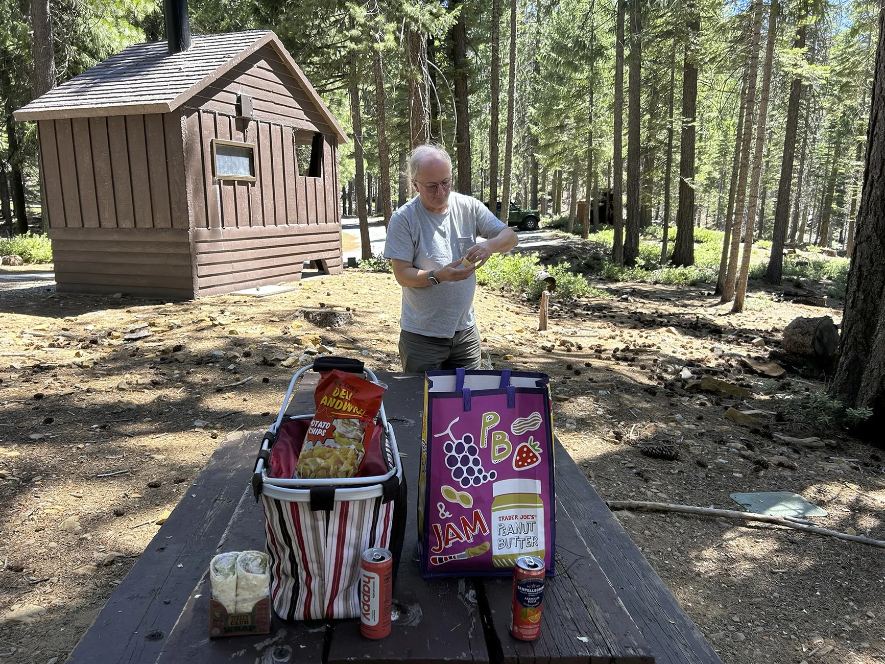
After a while we turned off for the Placer County Big Trees, the northernmost natural grove of giant sequoias, for a picnic. Since you get to the trees by hiking and my wife has a bad foot, I reserved the trees themselves for a later trip on my own. We just had a nice quiet picnic with almost nobody around. That's our Bronco in the background. Wife picks the picnic gear. Where are all the people on a Sunday?

So far this is pretty tame and wouldn't really merit a mention on this forum. Anyway, we continued up the road to French Meadows Reservoir and tooled around a bit there. Then we were off to Hell Hole Reservoir on the Rubicon River. Yes, that Rubicon River. The Rubicon Trail crosses the river about 5 miles upstream of the far upper end of the reservoir, but is accessed from roads farther south. The road to the dam was in pretty bad shape with loads of potholes, but they were merely an inconvenience. The dam itself had washed out when it was under construction in 1964 (thanks to an extreme flood) but was rebuilt in 1966.
My plan was to loop back on Forest Road 23 which runs along the top of Ralston Ridge, connecting back to the Mosquito Ridge Road and Foresthill. It looked like a nice loop on the map and the fastest way back. According to the map it was paved all the way though really winding towards the end.
Well, first I missed a turn and drove for about five miles on the wrong road, Forest Road 2. Our travel direction looked wrong after a while which is when I discovered my my mistake. So, I turned around and took a shortcut back to the correct road. We continued along the top of Ralston Ridge, mostly through privately held timberland (Sierra Pacific Industries).
The wild bitter cherries alongside the roads were having a good fruiting year. My wife is scared of bears. So of course we saw several piles of bear scat on the road, clearly marked by the abundance of cherry pits in them. She could no longer maintain the comforting semi-serious fiction that 'there's no bears in these woods'. Later, I saw a rattlesnake crossing the road, and at a bathroom break she heard a rattler making its rattle after I got out. I was extra careful at that stop, but we never actually saw the snake in the vegetation.
The overall area, far beyond our immediate ridge, had been hit hard by a forest fire in 2022. This fire burned partly on US Forest Service land and partly on private timberland. You'll see some of this in the photos.
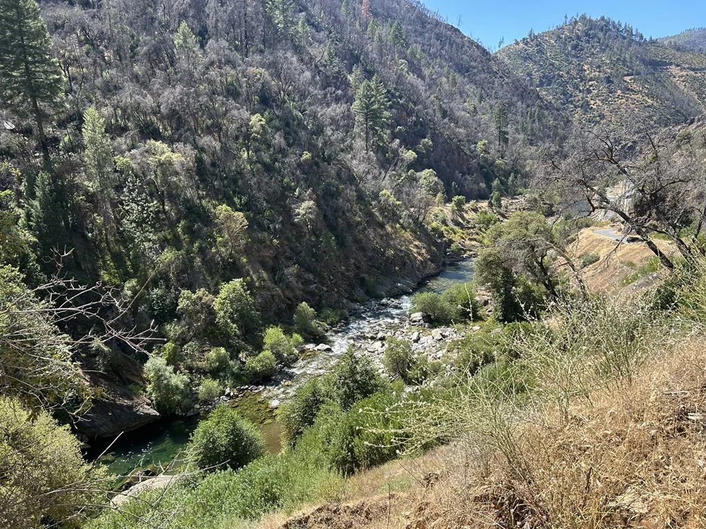
Here's a general view of the countryside down in the canyons:

Most of this had burned only three years ago. That road at the bottom of the canyon on the left is where we're planning to go, to be followed by climbing to the ridge on the horizon via Forest Road 96.
Well, this isn't hard:

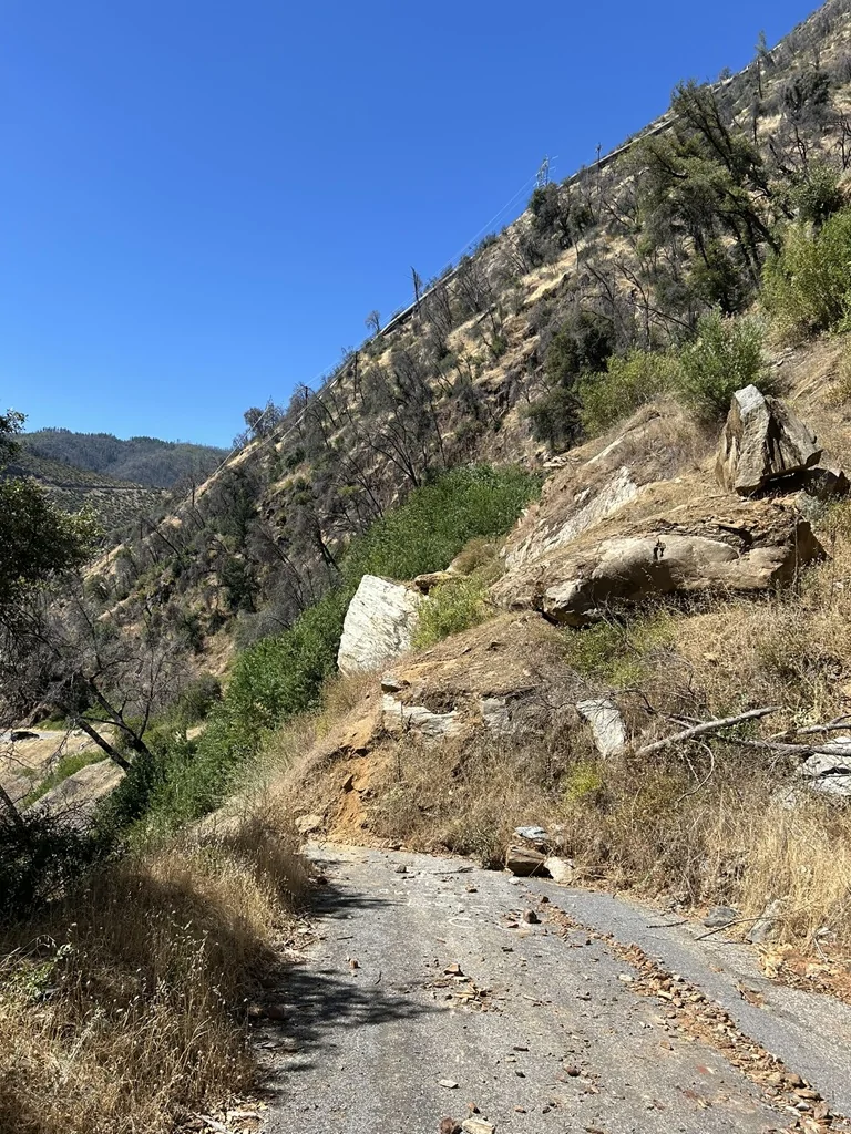
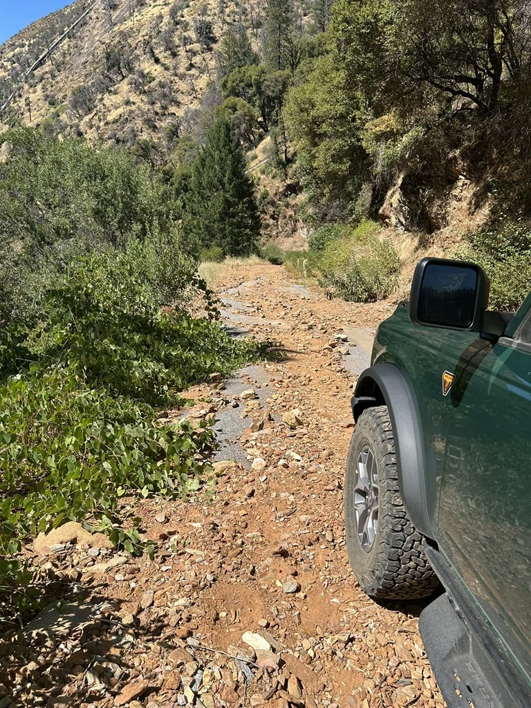
At this point were were accustomed to poorly maintained roads with very little traffic.
Hey... if you're going to leave your gear unattended and partly blocking a public road, it ain't my fault if I have to drive over the hose and the rope to get through. I'm sure not driving dozens of miles out of the way to get around this. Anyway, nobody was there and we kept on going.

Hmmm.... they're really not maintaining this road! At least I can see there's still a little traffic now and then.
To be continued.....
We're pretty new in the Sacramento area in northern California, though I've been through the area and up in the mountains on the major highways many times. My back-road explorations in the state have almost all been in other areas, though. Now I'm gradually exploring my new local mountains, looking for good places to go in the future for wheeling, camping, nature photography, and just getting away from it all.
We'd already been to Loon Lake and Union Valley Reservoir to the south earlier in the summer in our van. I'd been exploring dirt roads in the headwaters of the North Fork American River just a little farther north only a week earlier.
So, I took my wife on an exploration of paved (don't leave just yet, it gets more fun than you might expect!) roads to get a feel for some more areas I mostly hadn't been to yet. My wife hates bumpy dirt roads/trails which is why I was sticking to paved roads on this trip. This was also to be the final break-in for the Bronco as it went over 1K miles by the end of the day, though I hadn't expected that at the beginning. I didn't bother packing emergency gear because this ride was going to be a day trip on well-traveled paved roads, or so I thought.
The trip started fine. We went up the hill to Auburn on I-80, then turned off and drove to Foresthill where I hadn't been since 1980 or so. From there we went up the Mosquito Ridge Road (Forest Road 96), dropping down into the canyon of the Middle Fork of the American River then climbing up to Mosquito Ridge.
After a while we turned off for the Placer County Big Trees, the northernmost natural grove of giant sequoias, for a picnic. Since you get to the trees by hiking and my wife has a bad foot, I reserved the trees themselves for a later trip on my own. We just had a nice quiet picnic with almost nobody around. That's our Bronco in the background. Wife picks the picnic gear. Where are all the people on a Sunday?
So far this is pretty tame and wouldn't really merit a mention on this forum. Anyway, we continued up the road to French Meadows Reservoir and tooled around a bit there. Then we were off to Hell Hole Reservoir on the Rubicon River. Yes, that Rubicon River. The Rubicon Trail crosses the river about 5 miles upstream of the far upper end of the reservoir, but is accessed from roads farther south. The road to the dam was in pretty bad shape with loads of potholes, but they were merely an inconvenience. The dam itself had washed out when it was under construction in 1964 (thanks to an extreme flood) but was rebuilt in 1966.
My plan was to loop back on Forest Road 23 which runs along the top of Ralston Ridge, connecting back to the Mosquito Ridge Road and Foresthill. It looked like a nice loop on the map and the fastest way back. According to the map it was paved all the way though really winding towards the end.
Well, first I missed a turn and drove for about five miles on the wrong road, Forest Road 2. Our travel direction looked wrong after a while which is when I discovered my my mistake. So, I turned around and took a shortcut back to the correct road. We continued along the top of Ralston Ridge, mostly through privately held timberland (Sierra Pacific Industries).
The wild bitter cherries alongside the roads were having a good fruiting year. My wife is scared of bears. So of course we saw several piles of bear scat on the road, clearly marked by the abundance of cherry pits in them. She could no longer maintain the comforting semi-serious fiction that 'there's no bears in these woods'. Later, I saw a rattlesnake crossing the road, and at a bathroom break she heard a rattler making its rattle after I got out. I was extra careful at that stop, but we never actually saw the snake in the vegetation.
The overall area, far beyond our immediate ridge, had been hit hard by a forest fire in 2022. This fire burned partly on US Forest Service land and partly on private timberland. You'll see some of this in the photos.
Here's a general view of the countryside down in the canyons:
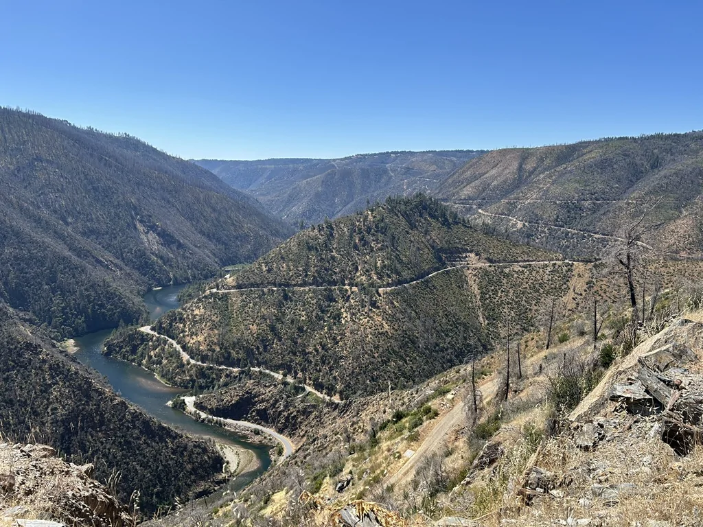
Most of this had burned only three years ago. That road at the bottom of the canyon on the left is where we're planning to go, to be followed by climbing to the ridge on the horizon via Forest Road 96.
Well, this isn't hard:
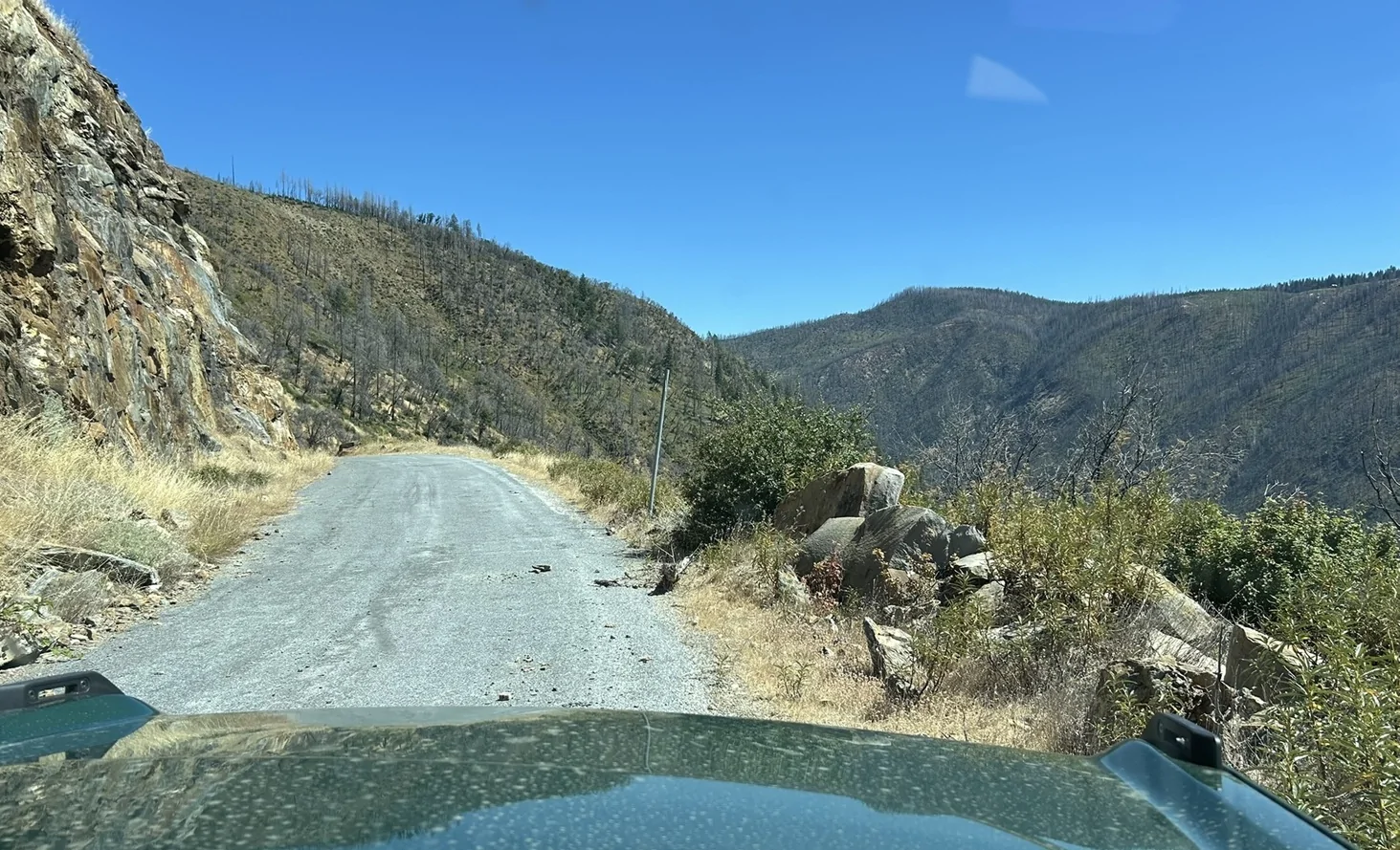
At this point were were accustomed to poorly maintained roads with very little traffic.
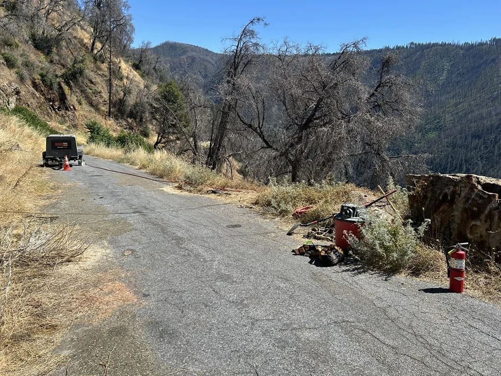
Hey... if you're going to leave your gear unattended and partly blocking a public road, it ain't my fault if I have to drive over the hose and the rope to get through. I'm sure not driving dozens of miles out of the way to get around this. Anyway, nobody was there and we kept on going.
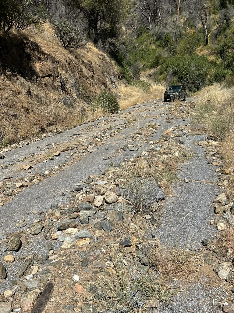
Hmmm.... they're really not maintaining this road! At least I can see there's still a little traffic now and then.
To be continued.....
Sponsored