- First Name
- Glenn
- Joined
- Aug 6, 2020
- Threads
- 6
- Messages
- 87
- Reaction score
- 535
- Location
- Austin, Texas
- Vehicle(s)
- 1994 Isuzu Trooper
- Your Bronco Model
- Base
- Thread starter
- #1
I wrapped up yet another road trip with the Bronco. Really no off-roading this trip other than a few dirt or gravel roads, but my main focus this trip was getting to the Sierra Nevadas as quickly as possible, hike a little, and relax in some beautiful big name places. Despite having the Sasquatch package, this is my main intention with the Bronco.
Again I used the Hele bed platform with the rear seats removed (though the bed fits with seats in), and really enjoy this setup. I don't like having any gear mounted on the exterior, and I prefer ease of access to everything inside. Sometimes I think about trading in the Bronco for a van so I can have a bit more space to cook and pack more adventure gear, but the custom build Bronco I waited 2 years during covid is still my dream vehicle and makes more sense for my day-to-day.
Everything functioned well, except for the dang soft top. I'm pretty sure I've got a bad one that doesn't latch correctly near the B pillar- I think I saw a TSB years back and wanted my dealer to check mine out, but I didn't want to leave the Bronco there for several days. Every trip- really anytime I'm on an interstate, wind more than 5mph seeps in through turning the top into a giant sail. I'm usually the slow guy on the road, and in some areas with heavier gusts I feel like I need to drive 10mph under to maintain steady control. After 5 of these longer road trips I'm ready to place an order with Armadillo before the next trip.
And finally, here's a breakdown of the trip:
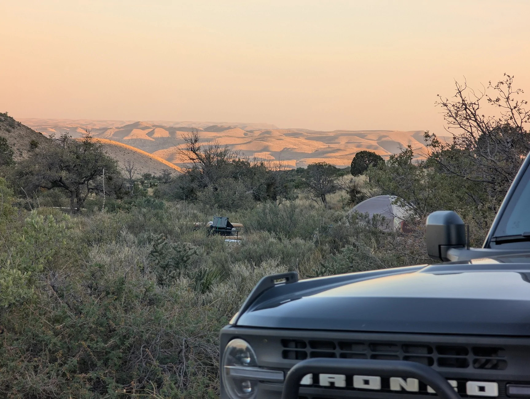
Day 1: 700 miles from Houston, TX to Guadalupe Mountains NP
My first day is usually my longest day, trying to cover the most distance. It would have been cool to hike to Guadalupe Peak, but 2 nights are really necessary to do that after such a long drive. Not the coolest national park in Texas with limited trails, but I aways enjoy camping here. This was my first and only night in a tent.


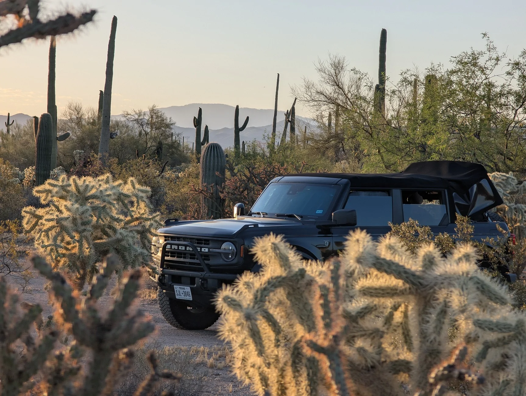
Day 2: 475 miles to Saguaro NP
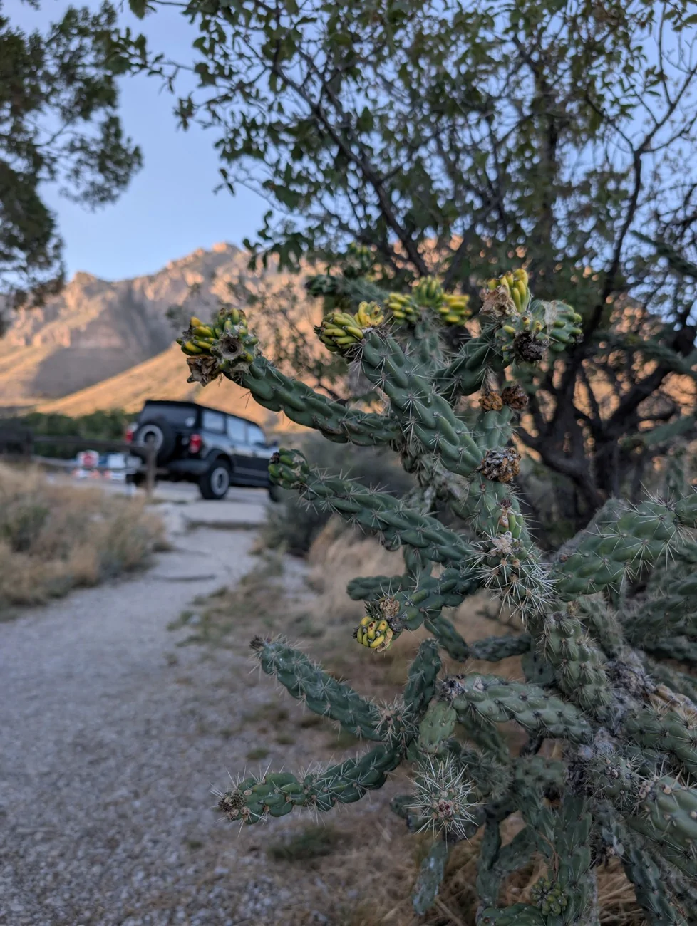
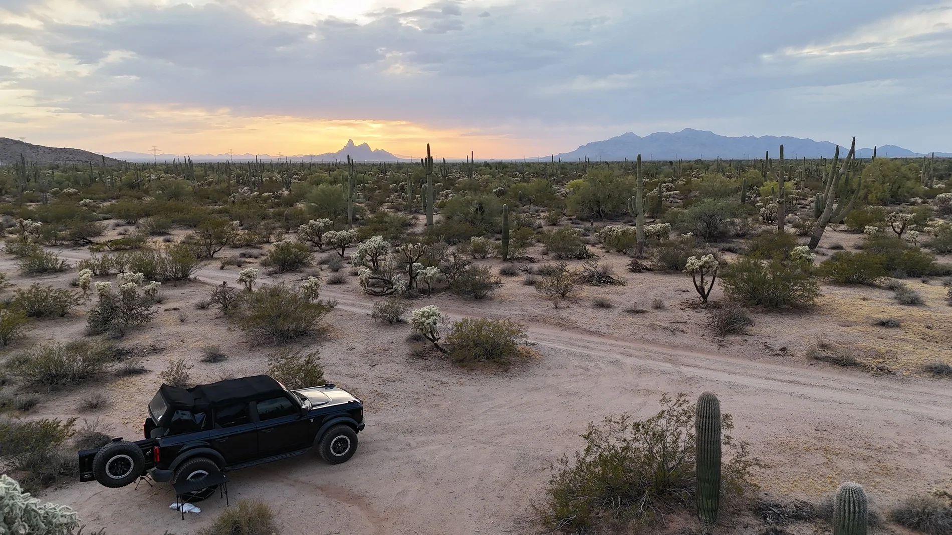
This isn't technically Saguaro NP, but pretty close to it good for some free camping. A small kit-fox appeared and was pretty interested in what I was doing for a bit before scurrying away. That was my first time seeing one so that was neat.

Day 3: 590 miles to Bakersfield, CA
This was my first hotel night. It's nice to score a hotel after 3 long days of driving. I'd like to find a spot I like to camp at around here, but with warmer weather more inclined to get a cheap motel anyway. No cool pics here.
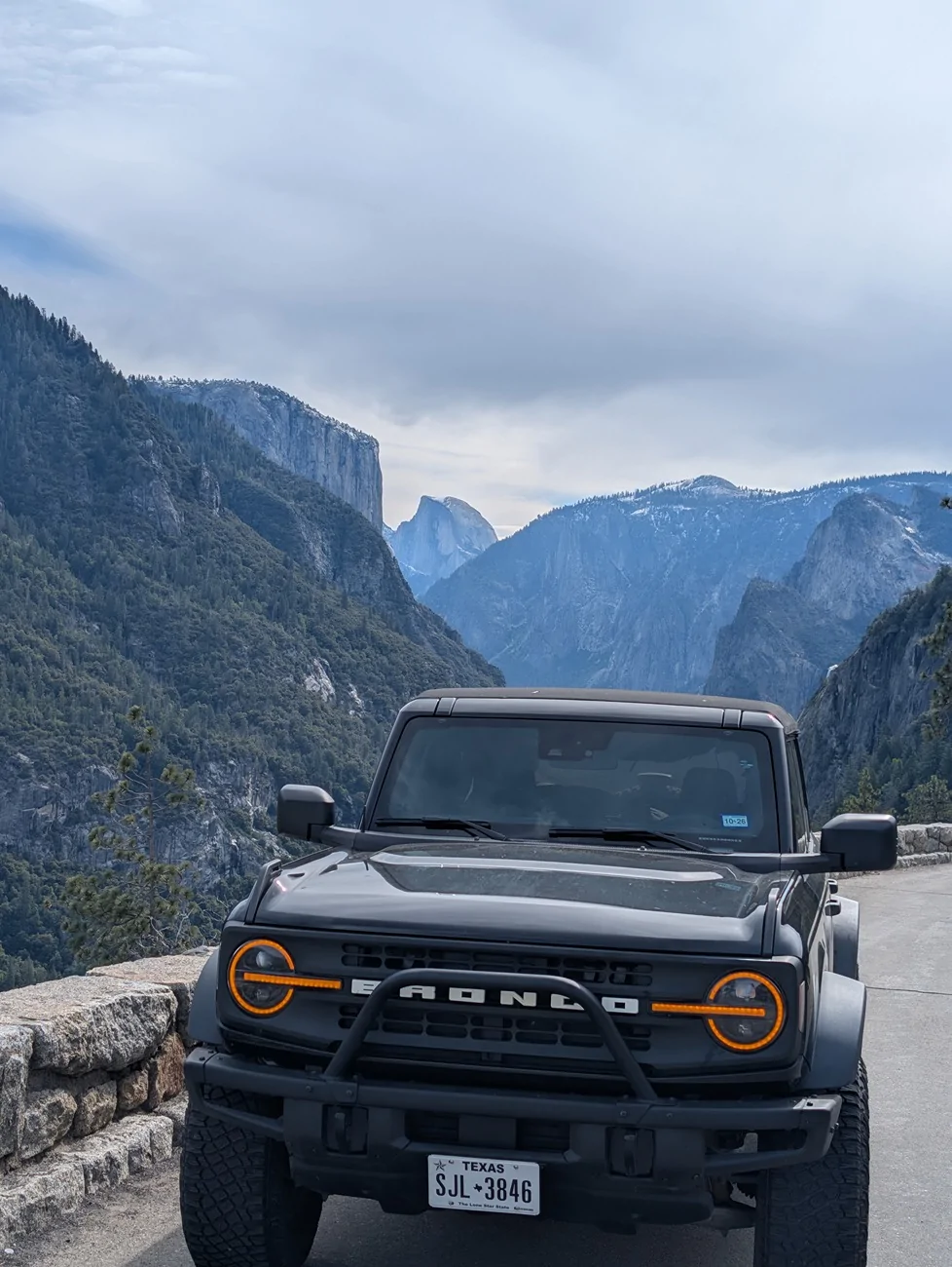
Days 4, 5, and 6: 255 miles to Yosemite NP
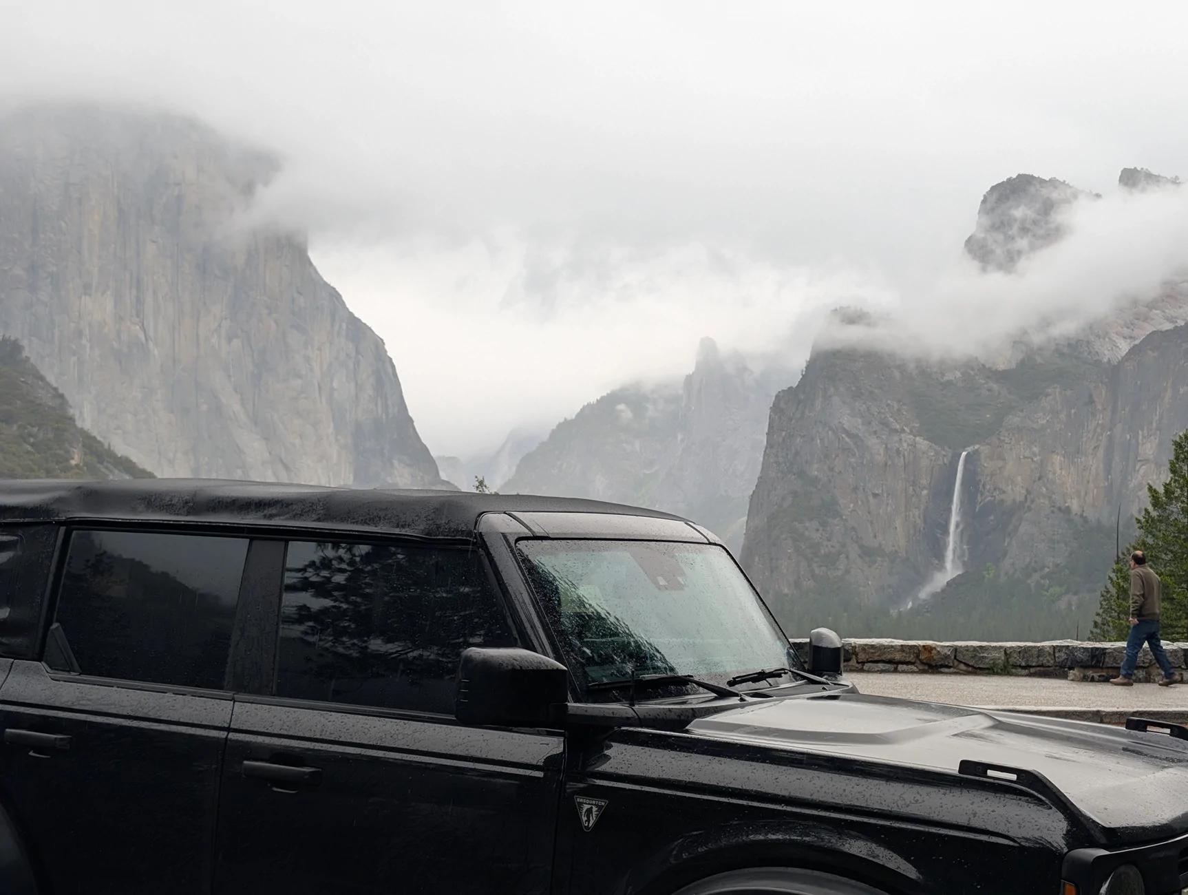
This is the first part of the trip I booked. My first experience here was a year ago, and I've been eager to get back- I just love it here. I originally planned to drive through Sequoia NP this day, but a winter storm was rolling in and I wanted to get to Yosemite before conditions worsened and R3 tire chain restrictions would be in effect. I added extra milage and hours this morning as I thought the higher-elevation 41 road would get more snow, so I tried the east entrance through El Portal but was turned around as the road was closed due to landslides. How did I miss this? I reversed course, then entered through the south entrance around 8am without issue or wait.
Steady, cold rain all day with clouds blocked most of the visibility of the valley's major icons. Then suddenly wind gusts picked up, and the rain turned to snow. This wasn't really sticking well in the valley, but it was still nice to experience.
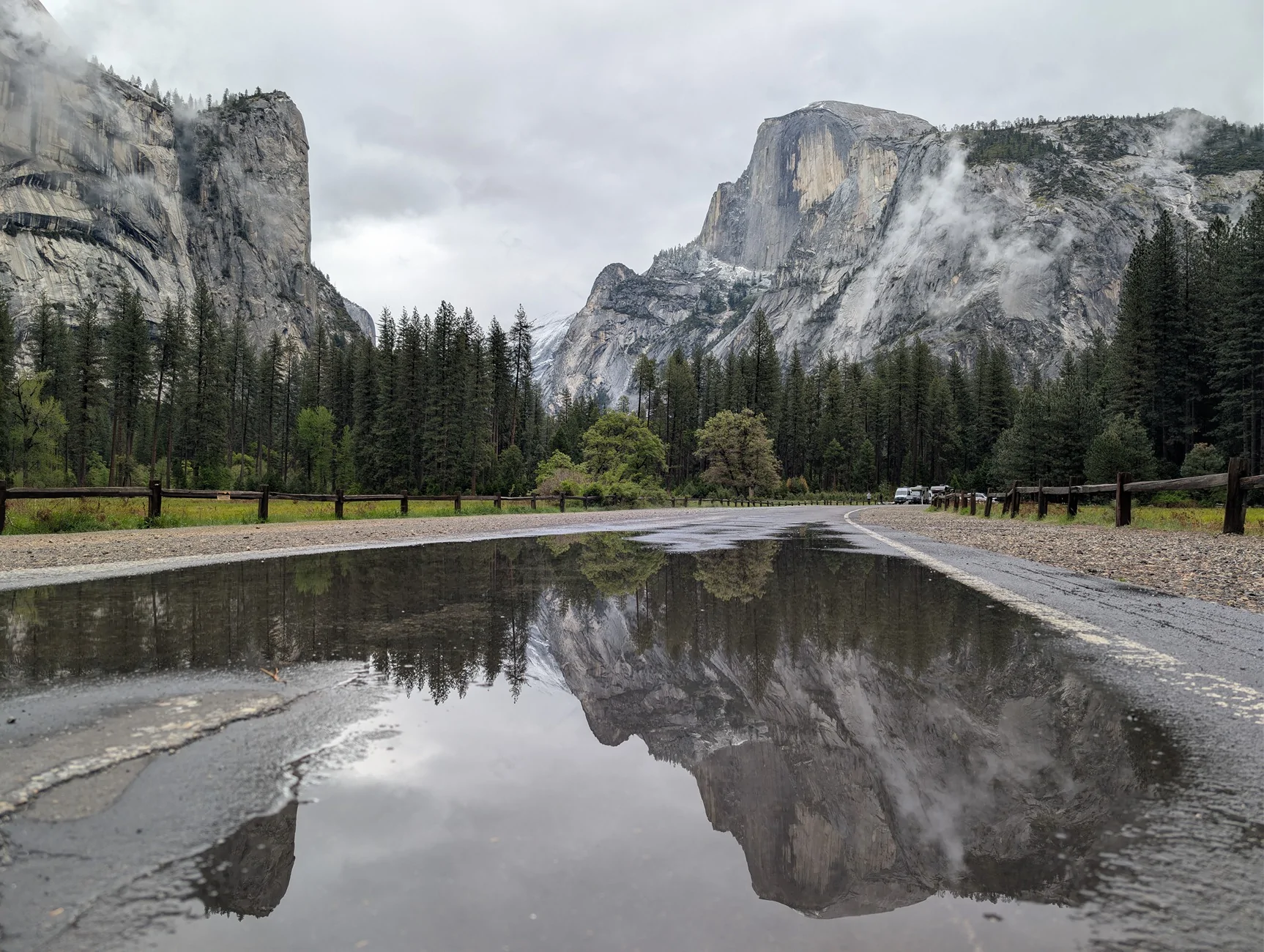
On my 2nd day in Yosemite, the clouds cleared and I revisited all of the points of interest I wanted to see from the first day, and the snowcapped high sierra were just stunning. I was planning on doing my longer hike this day, but I read that helicopter training was taking place on one of the connecting trails I wanted to do and shut that down. I had a wonderful time exploring all around the valley.
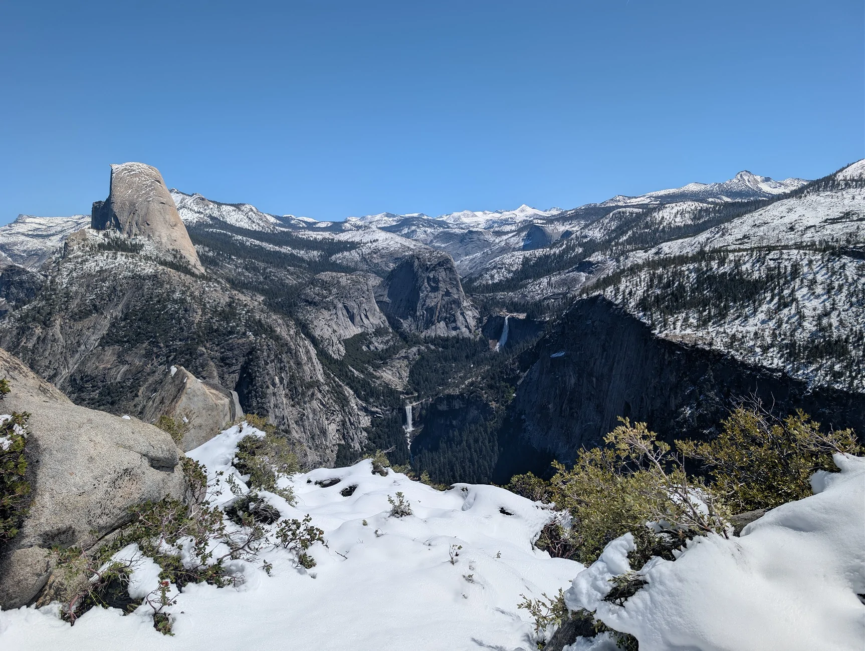
On the 3rd day I woke up at 4am in the freezing cold, put on my freezing hydration pack that leaked through the backpack, and got right into the hike. I was doing the Mist Trail to Panorama Trail, down the Four Mile Trail, which came to about 14.5 miles after all my detours and somewhere around 4,400 feet of elevation gain. The first several miles I handled without issue- I've been up to Nevada Fall before.

Shortly after this point I was met with 1-2 feet of snow blanketing the higher sierra. At the same time, I could hear the sound of of a helicopter- their training must have been pushed back a day! I felt like I needed to take cover and hide out of sight with each time they passed over. I didn't want to cause any trouble being on a trail I wasn't supposed to be on. Elevation continued to increase to Panorama Cliff, which was stunning yet slightly terrifying: only a few slippery steps away from falling thousands of feet. The elevation finally drops a bit here down to the Illilouette basin and Falls, before returning back to ass-kicking elevation gain. This stretch of the trail absolutely sapped me. The continuous elevation gain trekking through deep snow (without proper snow shoes) on the most exposed section of the trail made it feel like I might as well be in the desert- I have never struggled like this during a hike. After frequent stops and rubbing snow all over my head, I eventually made it up to Glacier Point and was relieved to see the first people since the valley floor. The hike down the steep Four Mile Trail was a breeze, although a little slushy from the foot traffic on this trail that clearly was not closed. I'm sure the hike up that during fresh snow must have been brutal. The lower waterfall in this pic is the same waterfall I'm at in the pic above.
I returned to camp, my final night along the beautiful Merced River and under the majestic Half Dome. All 3 nights here were in the teens I believe, the coldest camping I've done.
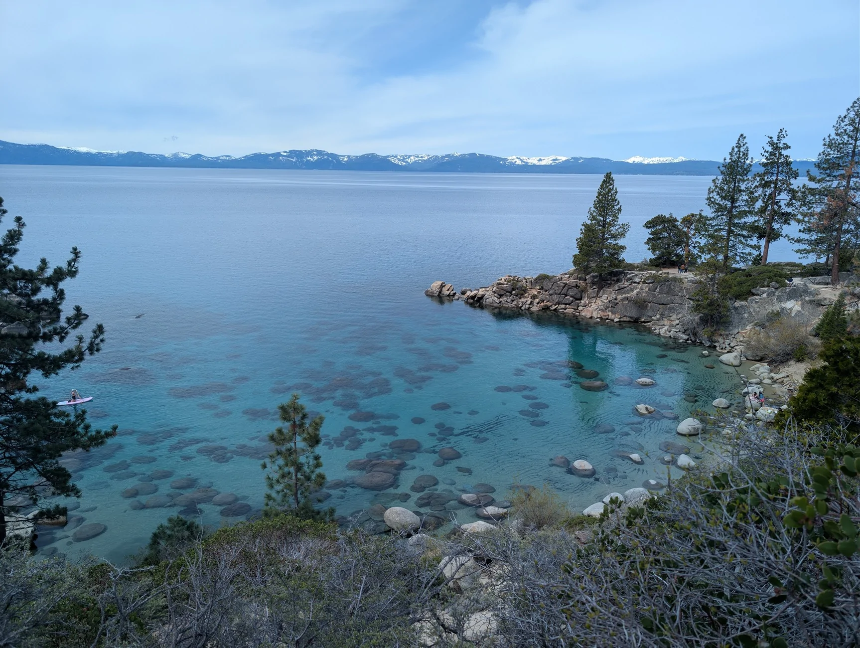
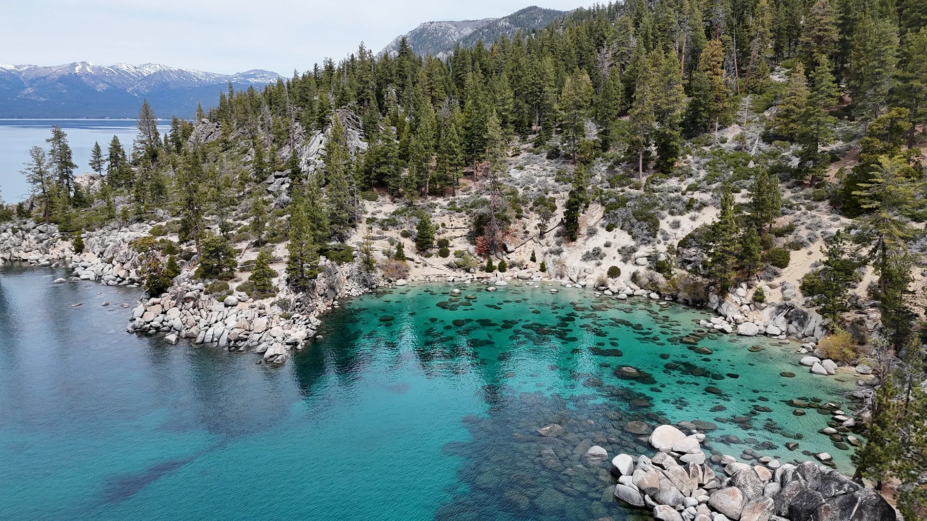
Days 7 and 8: 265 miles to Lake Tahoe
I had a few hikes planned, but the trails from the day before absolutely wrecked me. I bailed on my hikes at Tahoe and ended up cold-plunging for two days. I had two hotel nights booked in South Lake Tahoe, nice to break up the freezing nights in the Sierras.
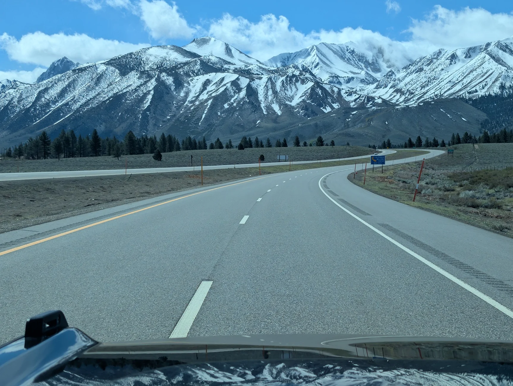
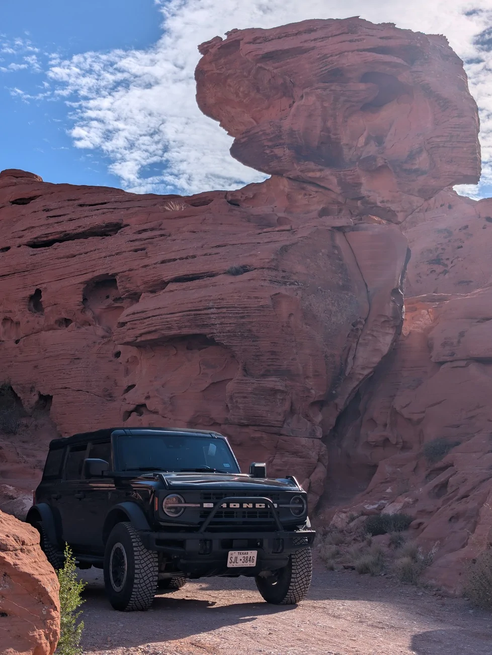
Day 9: 485 miles to Vally of Fire
I took the scenic route down 395, enjoying my last bit of the beautiful snow capped sierras from a different perspective. I didn't catch any bighorn sheep at the park unfortunately, but enjoyed the sunset transforming the red rocks into molten core. The site I chose had a cool rock formation, but wasn't angled correctly to capture the glowing rocks.
Day 10: 150 miles to Zion NP
I've got to admit, Zion may be the most overrated park I've been to, at least in my opinion. The canyon is beautiful, but it's small and was absolutely packed with people. I wasn't expecting a private oasis, but I was still surprised how crowded it felt. I guess it's similar to Yosemite, but I feel like I have much more space in Yosemite to branch out, and hiking out of the valley will always see much less people. There were also campers nearby enjoying a fiesta with loud music well beyond quiet hours. I'm not too sure why a host didn't handle that situation. Definitely my least favorite sleep in a national park.
I didn't score a permit to Angels Landing, but after hearing about a guy falling off just a week prior and still recovering from Yosemite, I was fine just getting to Scout's Lookout and then getting out of Zion. I wanted to do another hike but that trail is closed indefinitely. One final hike I wanted to do exiting the park has extremely limited access, which I was not lucky enough to workout.
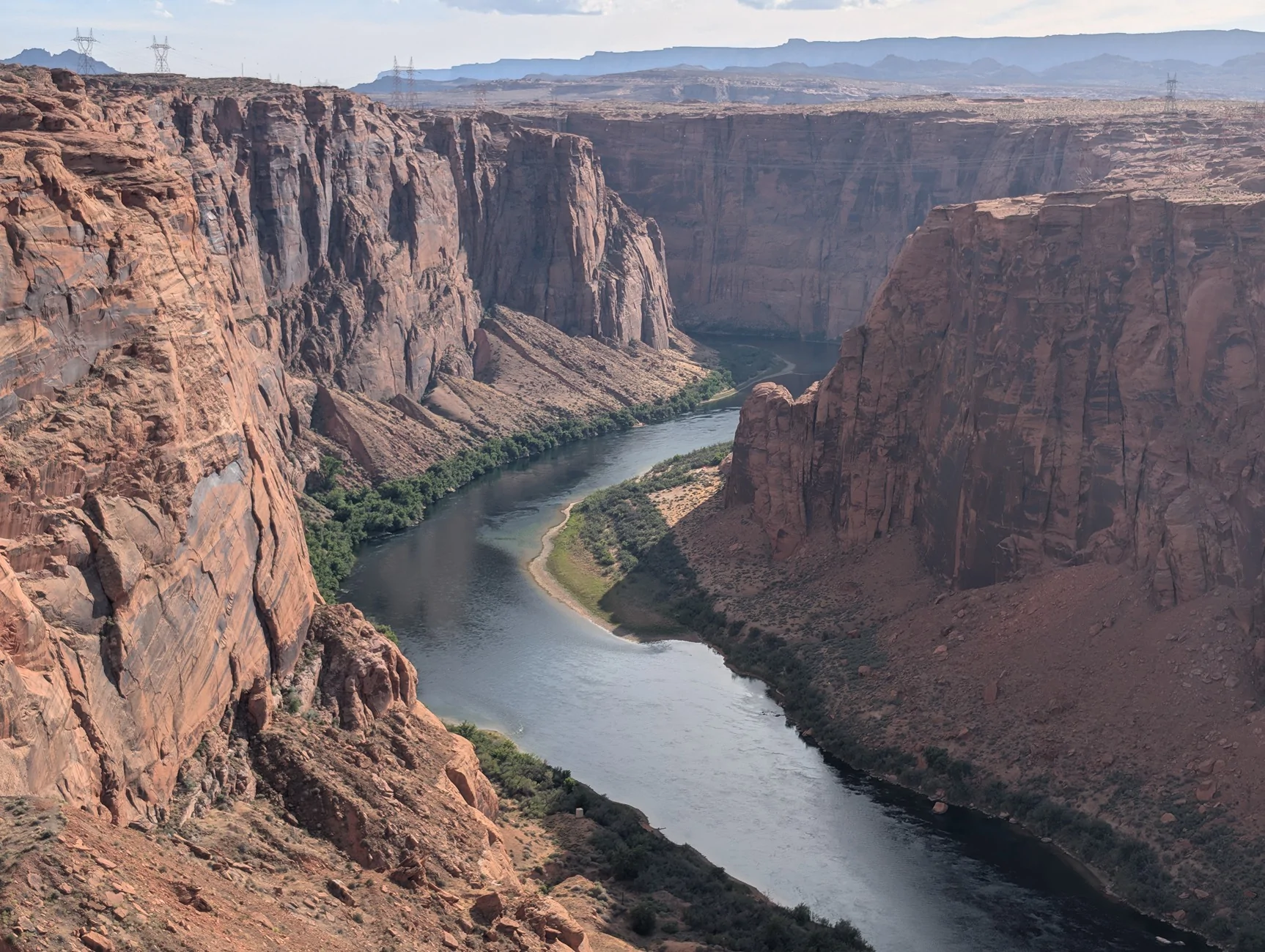
Day 11: 120 miles to Page, AZ
I stopped by Glen Canyon Dam and thought about sleeping here. Nearby was the popular Horseshoe Bend, but I didn't want to deal with a busy parking lot, pay $15 or so, and hike a couple of miles for a similar view where I was at which was free with a much shorter walk. My legs were still hurting from Yosemite, so I decided to get a massage with some of the downtime I had.
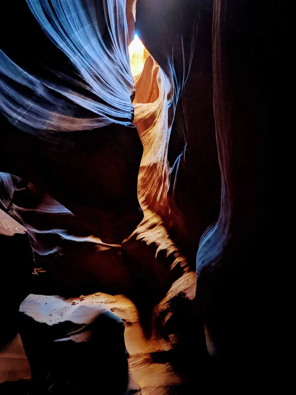
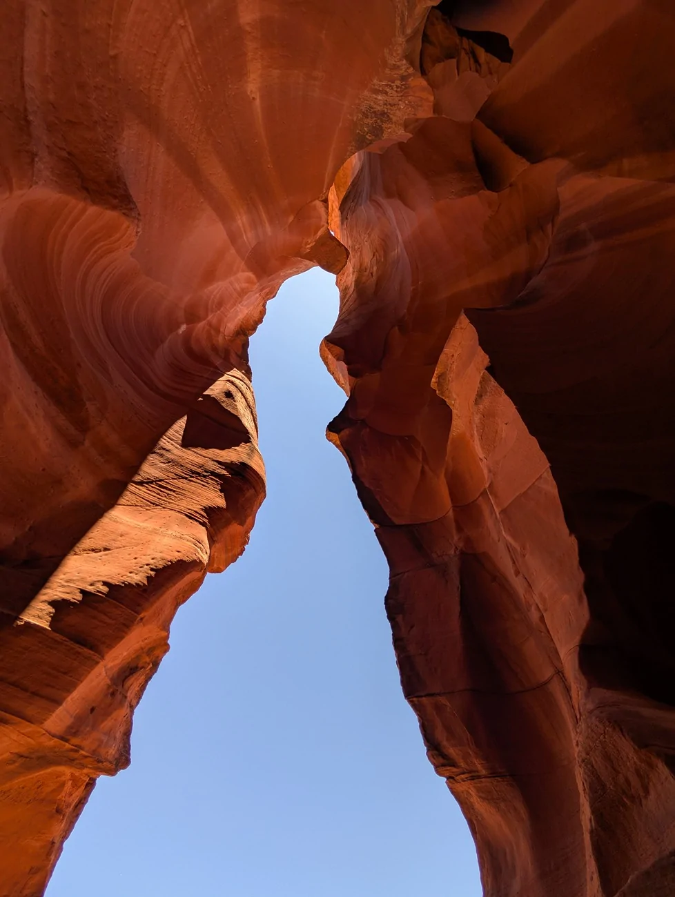
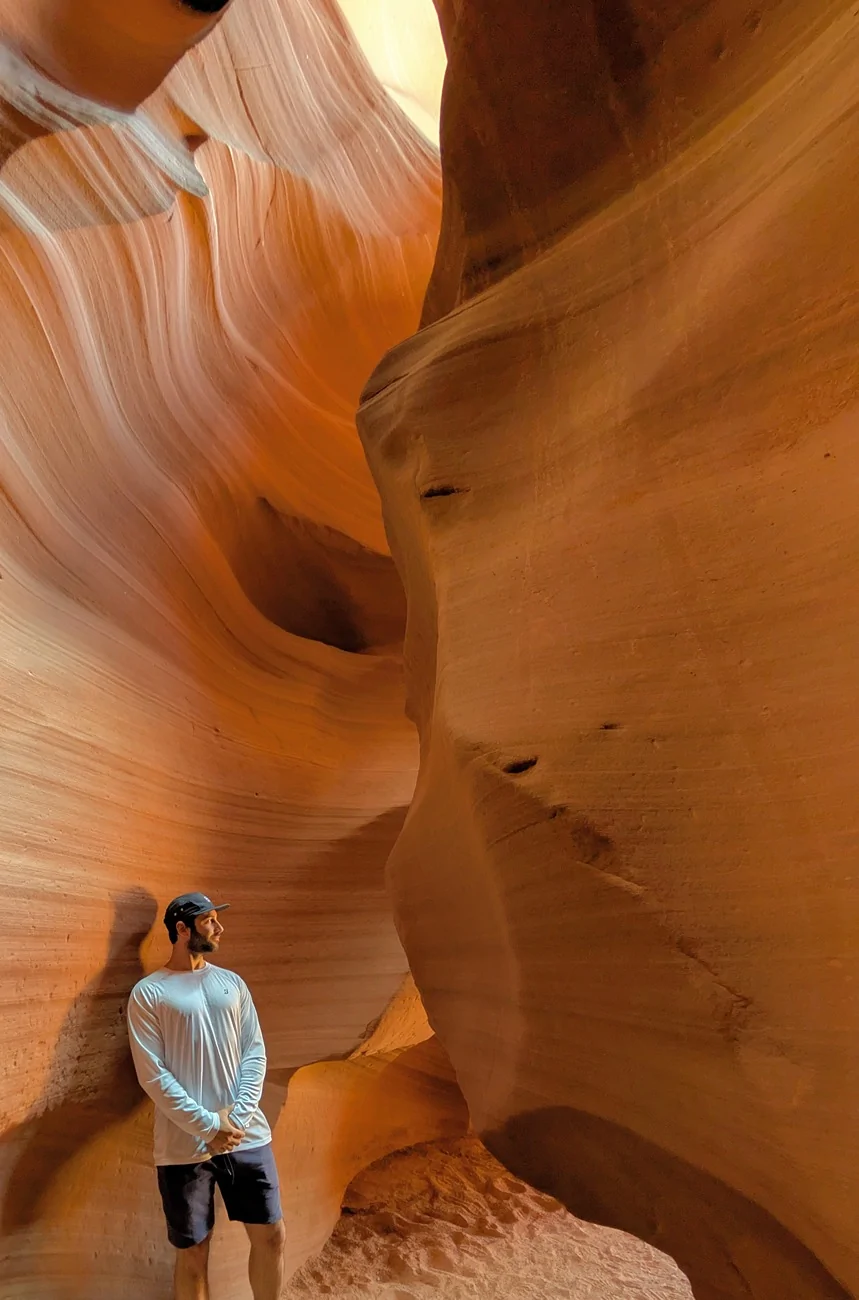
Later I toured the Lower Antelope Canyon. The guide pointed out various structures and shapes and what objects they appeared to resemble. The first one stood out the clearest to me- lady in a blue dress. I didn't get the infamous light rays, but it was still a very enjoyable experience.

Days 12 and 13: 240 miles to Sedona, AZ
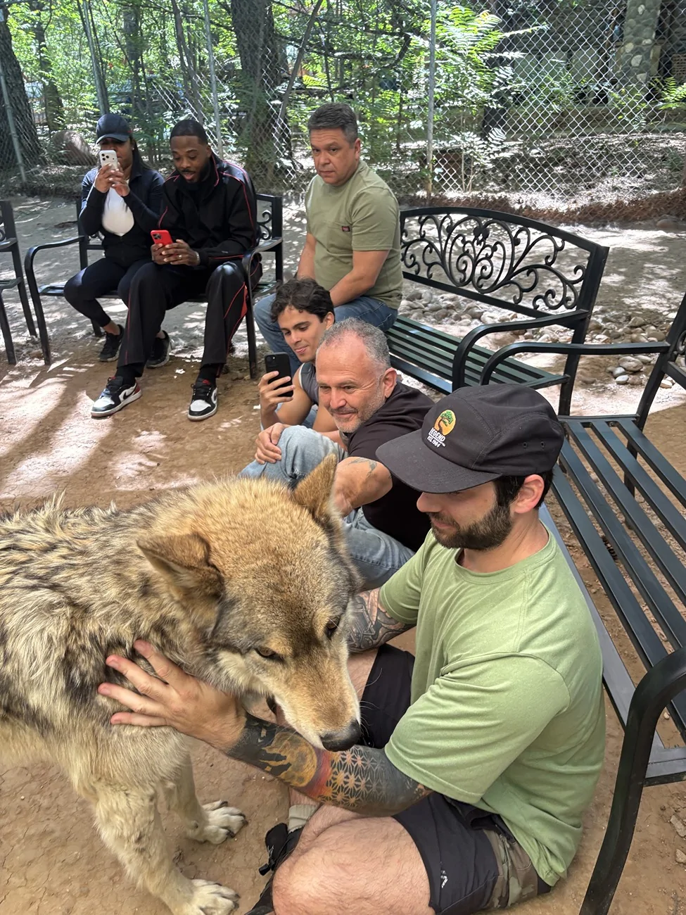
I camped at Manzanita, next Slide Rock State Park. I've been here before and thoroughly enjoyed my stay here. It's right along the creek and very peaceful. I went to Slide Rock State Park both days, and visited the enchanting Sedona Wold Sanctuary the second day. It was fascinating learning about the land used from previous tribes, and learning about the wolves. This along with Yosemite were the top two highlights of this trip, so it was nice to go out with a bang.

Day 14: 680 miles to Brownfield, TX
I was planning on finishing with White Sands NP, but I was ready to get home at this point. Next time White Sands, next time.
Day 15: 550 miles to Dayton, TX
Nothing exciting to report, other than cheaper gas, sweet Texas.
Again I used the Hele bed platform with the rear seats removed (though the bed fits with seats in), and really enjoy this setup. I don't like having any gear mounted on the exterior, and I prefer ease of access to everything inside. Sometimes I think about trading in the Bronco for a van so I can have a bit more space to cook and pack more adventure gear, but the custom build Bronco I waited 2 years during covid is still my dream vehicle and makes more sense for my day-to-day.
Everything functioned well, except for the dang soft top. I'm pretty sure I've got a bad one that doesn't latch correctly near the B pillar- I think I saw a TSB years back and wanted my dealer to check mine out, but I didn't want to leave the Bronco there for several days. Every trip- really anytime I'm on an interstate, wind more than 5mph seeps in through turning the top into a giant sail. I'm usually the slow guy on the road, and in some areas with heavier gusts I feel like I need to drive 10mph under to maintain steady control. After 5 of these longer road trips I'm ready to place an order with Armadillo before the next trip.
And finally, here's a breakdown of the trip:
Day 1: 700 miles from Houston, TX to Guadalupe Mountains NP
My first day is usually my longest day, trying to cover the most distance. It would have been cool to hike to Guadalupe Peak, but 2 nights are really necessary to do that after such a long drive. Not the coolest national park in Texas with limited trails, but I aways enjoy camping here. This was my first and only night in a tent.
Day 2: 475 miles to Saguaro NP
This isn't technically Saguaro NP, but pretty close to it good for some free camping. A small kit-fox appeared and was pretty interested in what I was doing for a bit before scurrying away. That was my first time seeing one so that was neat.

Day 3: 590 miles to Bakersfield, CA
This was my first hotel night. It's nice to score a hotel after 3 long days of driving. I'd like to find a spot I like to camp at around here, but with warmer weather more inclined to get a cheap motel anyway. No cool pics here.
Days 4, 5, and 6: 255 miles to Yosemite NP
This is the first part of the trip I booked. My first experience here was a year ago, and I've been eager to get back- I just love it here. I originally planned to drive through Sequoia NP this day, but a winter storm was rolling in and I wanted to get to Yosemite before conditions worsened and R3 tire chain restrictions would be in effect. I added extra milage and hours this morning as I thought the higher-elevation 41 road would get more snow, so I tried the east entrance through El Portal but was turned around as the road was closed due to landslides. How did I miss this? I reversed course, then entered through the south entrance around 8am without issue or wait.
Steady, cold rain all day with clouds blocked most of the visibility of the valley's major icons. Then suddenly wind gusts picked up, and the rain turned to snow. This wasn't really sticking well in the valley, but it was still nice to experience.

On my 2nd day in Yosemite, the clouds cleared and I revisited all of the points of interest I wanted to see from the first day, and the snowcapped high sierra were just stunning. I was planning on doing my longer hike this day, but I read that helicopter training was taking place on one of the connecting trails I wanted to do and shut that down. I had a wonderful time exploring all around the valley.
On the 3rd day I woke up at 4am in the freezing cold, put on my freezing hydration pack that leaked through the backpack, and got right into the hike. I was doing the Mist Trail to Panorama Trail, down the Four Mile Trail, which came to about 14.5 miles after all my detours and somewhere around 4,400 feet of elevation gain. The first several miles I handled without issue- I've been up to Nevada Fall before.

Shortly after this point I was met with 1-2 feet of snow blanketing the higher sierra. At the same time, I could hear the sound of of a helicopter- their training must have been pushed back a day! I felt like I needed to take cover and hide out of sight with each time they passed over. I didn't want to cause any trouble being on a trail I wasn't supposed to be on. Elevation continued to increase to Panorama Cliff, which was stunning yet slightly terrifying: only a few slippery steps away from falling thousands of feet. The elevation finally drops a bit here down to the Illilouette basin and Falls, before returning back to ass-kicking elevation gain. This stretch of the trail absolutely sapped me. The continuous elevation gain trekking through deep snow (without proper snow shoes) on the most exposed section of the trail made it feel like I might as well be in the desert- I have never struggled like this during a hike. After frequent stops and rubbing snow all over my head, I eventually made it up to Glacier Point and was relieved to see the first people since the valley floor. The hike down the steep Four Mile Trail was a breeze, although a little slushy from the foot traffic on this trail that clearly was not closed. I'm sure the hike up that during fresh snow must have been brutal. The lower waterfall in this pic is the same waterfall I'm at in the pic above.
I returned to camp, my final night along the beautiful Merced River and under the majestic Half Dome. All 3 nights here were in the teens I believe, the coldest camping I've done.

Days 7 and 8: 265 miles to Lake Tahoe
I had a few hikes planned, but the trails from the day before absolutely wrecked me. I bailed on my hikes at Tahoe and ended up cold-plunging for two days. I had two hotel nights booked in South Lake Tahoe, nice to break up the freezing nights in the Sierras.
Day 9: 485 miles to Vally of Fire
I took the scenic route down 395, enjoying my last bit of the beautiful snow capped sierras from a different perspective. I didn't catch any bighorn sheep at the park unfortunately, but enjoyed the sunset transforming the red rocks into molten core. The site I chose had a cool rock formation, but wasn't angled correctly to capture the glowing rocks.
Day 10: 150 miles to Zion NP
I've got to admit, Zion may be the most overrated park I've been to, at least in my opinion. The canyon is beautiful, but it's small and was absolutely packed with people. I wasn't expecting a private oasis, but I was still surprised how crowded it felt. I guess it's similar to Yosemite, but I feel like I have much more space in Yosemite to branch out, and hiking out of the valley will always see much less people. There were also campers nearby enjoying a fiesta with loud music well beyond quiet hours. I'm not too sure why a host didn't handle that situation. Definitely my least favorite sleep in a national park.
I didn't score a permit to Angels Landing, but after hearing about a guy falling off just a week prior and still recovering from Yosemite, I was fine just getting to Scout's Lookout and then getting out of Zion. I wanted to do another hike but that trail is closed indefinitely. One final hike I wanted to do exiting the park has extremely limited access, which I was not lucky enough to workout.

Day 11: 120 miles to Page, AZ
I stopped by Glen Canyon Dam and thought about sleeping here. Nearby was the popular Horseshoe Bend, but I didn't want to deal with a busy parking lot, pay $15 or so, and hike a couple of miles for a similar view where I was at which was free with a much shorter walk. My legs were still hurting from Yosemite, so I decided to get a massage with some of the downtime I had.
Later I toured the Lower Antelope Canyon. The guide pointed out various structures and shapes and what objects they appeared to resemble. The first one stood out the clearest to me- lady in a blue dress. I didn't get the infamous light rays, but it was still a very enjoyable experience.
Days 12 and 13: 240 miles to Sedona, AZ
I camped at Manzanita, next Slide Rock State Park. I've been here before and thoroughly enjoyed my stay here. It's right along the creek and very peaceful. I went to Slide Rock State Park both days, and visited the enchanting Sedona Wold Sanctuary the second day. It was fascinating learning about the land used from previous tribes, and learning about the wolves. This along with Yosemite were the top two highlights of this trip, so it was nice to go out with a bang.

Day 14: 680 miles to Brownfield, TX
I was planning on finishing with White Sands NP, but I was ready to get home at this point. Next time White Sands, next time.
Day 15: 550 miles to Dayton, TX
Nothing exciting to report, other than cheaper gas, sweet Texas.
Sponsored
Last edited:

 .
.